The Larapinta Trail: A Six Day Recce
TAKE A
HIKE
AND
GET LOST
IN THE
RIGHT
DIRECTION
By Chris.
In September 2019, my dad and I set off to Alice Springs for a Larapinta Trail adventure. The goal was to complete half of the Larapinta Trail: a 231km walking trail extending from Alice Springs to Redbank Gorge along the West MacDonnell Ranges in the Northern Territory.
The trail is split into twelve sections. These can be done as day or multi-day walks, with varying itineraries. Walking the trail End to End (E2E) commonly takes between 13 to 15 days, or if you are an ultra-marathon runner, 60 hours and 59 minutes!
It took us six days to walk from Redbank Gorge to Ellery Creek Big Hole, with a detour via Mount Giles. We walked approximately 104 kilometres.
Check out a map of the area!
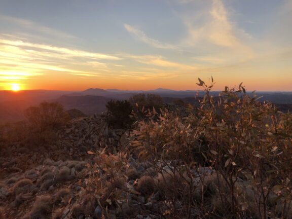
DAY 1: RAIN IN THE DESERT!
Redbank Gorge to Rocky Bar Gap ~ 17km
Day one saw the first rain the region had experienced in months. After being dropped off at Redbank Gorge, we did our final adjustments and shouldered our packs – remarkably not too heavy thanks to some recent purchases including a One Planet Goondie 2 tent and Nemo Tensor Insulated Sleeping Pad. First, we took the detour to the actual Redbank Gorge, being told it was a must-see. We were not disappointed; a short walk brought us to a spectacular pool surrounded by high jagged red cliffs.
Then, it was back onto the trail and up Mount Sonder (Rwetyepme), the fourth highest mountain in the NT. We followed the blue arrows up into the fog and mist.
After a few hours of climbing we reached the summit… to no view! It was pretty much a white-out – no visibility for more than 50 metres!
Slightly disappointed, though knowing we had experienced a unique occurrence and would have many views later on, we started our descent. Instead of backtracking, we planned to follow a ridgeline directly down to Rocky Bar Gap – our camp for the night. It turns out navigating in a white-out is tricky; we missed our ridge and ended up bush-bashing down random ridgelines covered in scree and spinifex (not the soft kind!) knowing we would eventually meet the trail.
Exhausted, with sundown approaching, we finally reached our friendly blue arrows again – with some nav lessons learned! Our tired legs walked the final few k’s to camp. Here we had the inaugural setup of my One Planet Goondie 2, into which we gladly collapsed after a quick meal.
DAY 2: HEATING UP
Rocky Bar Gap to Ormiston Gorge ~ 23km
We woke to sunny blue skies. The forecast was hot from now on with low 30s expected most days. Out from Rocky Bar Gap we saw splendid views of Mount Sonder, catching sight of our missed ridgeline.
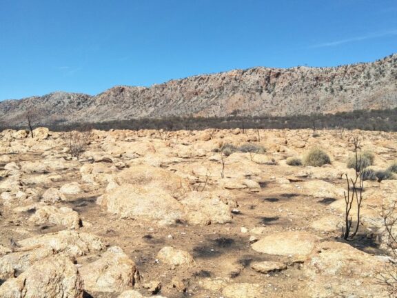
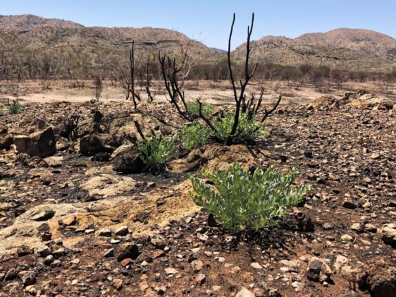
We walked up and then down into Glen Helen Junction and onto Finke River for lunch. Much of this walk was through burnt landscapes. Bushfires had sadly ravaged the area in early 2019, though the visible regrowth gave us optimism for recovery.
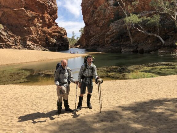
Out of the burnt areas and back into vegetation, we finished our day in Ormiston Gorge, a popular spot with a huge valley surrounded by sheer red cliffs. A close encounter with a dingo that night reminded us that we weren’t being paranoid keeping our bootlaces tied together overnight to stop them being stolen!
DAY 3: OFF THE BEATEN PATH
Ormiston Gorge to Mount Giles ~ 16km
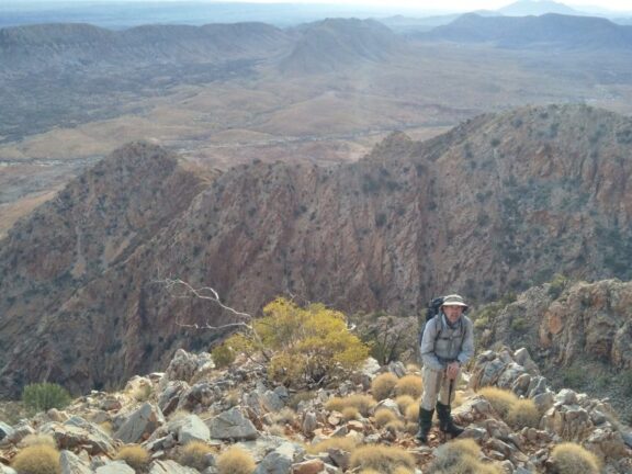
We started our day on the Ormiston Pound walk in the anti-clockwise direction, catching glimpses of our goal: the distant summit of Mount Giles (Ltharrkelipeke), the third-highest peak in the NT.
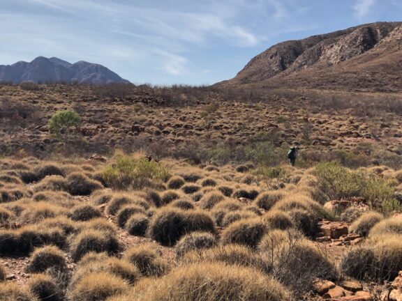
Entering Ormiston Pound, a spectacular valley ringed by tall cliffs, we left the beaten track. Navigation was straightforward: find the least undulating path towards the base of Mount Giles. Simple!
Despite our attempts, the route was undulating as ever over the ubiquitous spinifex and rock boulders. After a few hours we reached the base, feeling very much insignificant under the ominous flanks of the mountain.
A critical moment on the Larapinta Trail
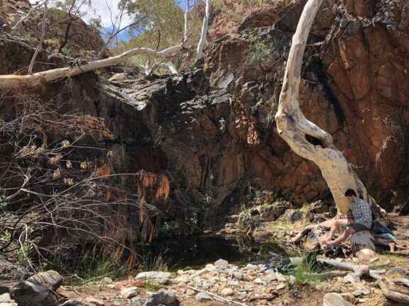
Now was an important moment. Essential really. Between us, we had 12 litres of water, enough for 3 litres/day each if we were to summit Mount Giles that day and continue afterwards. With the heat and lack of shade on our trip across the pound, we had quickly realised this would not be enough! Luckily, we had planned our ascent via a certain ridge and knew there was a spring at the base.
As we navigated to our ridge, we crossed our fingers. Bearing closer I heard a sound – the faint trickling of running water! Full of excitement, I rushed down the gully to find the source. Sure enough there was a puddle of water, grimy but running. Looking further we could see that the stream came from deep up the gully. It was like an oasis! The gully was full of green vegetation including massive MacDonnell Ranges Cycads, and pools of running water. We could now accomplish our goal!
We rested till late afternoon so to begin our ascent in the cooler part of the day. After treating the water we generously hydrated ourselves (far over our 3L budget now!). Mid-afternoon, we stripped our packs of unneeded gear and stashed it in a fortress of small boulders – we weren’t taking chances with dingoes and other critters about.
The climb
And off we set. Up precarious scree slopes and rock climbs, our lighter packs were much needed. The climb was tough, steep, and loose, along knife-edge ridgelines, with dramatic drops on either side. Each step rewarded us with increasingly superb views.
Finally, our ridge began to flatten out as we reached a high knoll. The view was amazing! We could see the trig on the summit, only about a kilometre away!
Climbing further, we were met with the usual: a big dip to a saddle between the high points! Oh well! We could see our goal now and pushed on through. With a final scramble up boulder-sized scree, we arrived at the summit just on sunset. This was one of the best views I’ve had the privilege to see: a 360 degree panorama looking north into ongoing ranges, east along the Chewings Range, south onto Heavitree range, and west to Ormiston Pound, Mount Sonder, and even Mount Zeil (The NT’s tallest mountain).
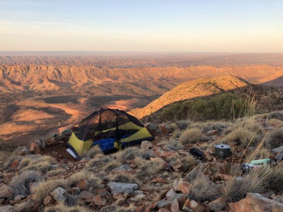
Several little campsites had been made by previous occupants and we took the best one. We had it all to ourselves! Up went the Goondie. With clear skies and no rain forecast, there was no need for the fly. As darkness fell, our bellies full of a well-deserved meal, we fell asleep as the sky opened to a magnificent myriad of stars.
DAY 4: IT’S ALWAYS UNDULATING ON THE LARAPINTA TRAIL
Sonder to Serpentine Chalet Dam ~ 21km
We awoke to the sun rising and illuminating our spectacular panorama. After soaking in the views one final time, we began our descent. We retraced our route, glad for our lighter packs, though this did not diminish the still-precarious ridgelines.
With fingers crossed, we rushed to find our gear stash. It was untouched! With a quick repack, bodies fully hydrated, and reservoirs full, we set off from this beautiful spring and mountain.
The plan was to cross the Alice Valley to where there was a gap in the Heavitree Range – this likely would have been a common route for the Arrernte people of the area – using Giles Spring and coming back across the valley into the shaded areas of the range.
Once again, navigation was straightforward. Just aim for the big gap in the range! We kept the map out to find the least undulating route, again to little success. It’s always undulating out there!
With little shade, the heat took its toll, and we were thankful for our water supply.
Eventually, we broke through the gap and once again met our friendly blue arrows. Back on the trail! We wound through Inarlanga Pass thankful for the shade and taking in the spectacular cycads. We continued on to Serpentine Chalet Dam to end day four.
DAY 5: A VIEW TO THE FUTURE
Serpentine Chalet Dam to Trig ~ 22km
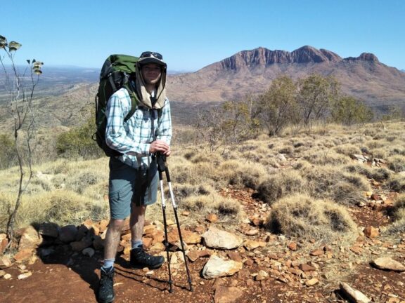
The morning took us up and on top of the Heavitree Range to Counts Point – a great campsite option (we’d been too tired to make it here, and we couldn’t beat Mount Giles views!). The Point gave us incredible views out to Mount Sonder and across through the gap into Alice Valley and Mount Giles.
We followed the trail along the top of the range with views of the far Chewings Range where the trail extends past Ellery Creek. This gave us an idea of what to expect for when we come back to finish the trail! We descended off the range and into Serpentine Gorge where we lunched and rested until late afternoon. Once into the cooler temperatures, we pushed on for a few k’s to a Trig Point for our final camp.
DAY 6: A REFRESHING SPLASH
Ellery Creek Big Hole ~ 7km
It was a short walk to Ellery Creek Big Hole on our final day. We arrived early morning and the pickup was not till early afternoon. This gave us a good few hours to rest by the popular water hole. A short dip in the pool was incredibly refreshing after six days of being hot and sweaty, despite it being the coldest water I’ve ever swum in!! Our pickup arrived, and we were done – back to Alice Springs for a warm shower, and to start planning our next trip.
ABOUT THE TRIP
Season
May to August are the most popular times to hike the trail, often with temperatures in the mid-20s. From our experience, September can still be fine if you stay hydrated and sun-safe, and avoid the hottest part of the day. Plus, you have the advantage of seeing very few people!
Night
Temperatures at night still got chilly, but with my One Planet Nitrous -1 it was warm! Rain can come at any time in the desert, but with confidence in the forecast, most nights we spent without the fly or in the great shelters at the campsites.
Transport
Depending on your itinerary, you will need a drop-off or pick-up at some point along the trail. Unless you either are or know a local, these are pricey. We had no resupplies and had a drop-off at Redbank Gorge and pickup at Ellery Creek – several companies offer this service, in addition to dropping resupplies off at points for you. Many companies also offer guided all-inclusive and glamping style packages to do the full trail or sections.
Direction
The trail can be walked from west to east (finishing at Redbank Gorge) or east to west (finishing in Alice Springs). Both have pros and cons. Walking W to E you have the sun in your face in the morning, and walking E to W the full sun will be on your face early afternoon. The latter is a good option when going E2E if you would like to do resupply drops on your way out to start at Redbank Gorge and not be constrained for a pickup date.
Maps
We used the Larapinta Trail Package section maps from NT Parks and Wildlife, as well as a copy of the Chapman’s Larapinta Trail book – it was some added weight but both gave us useful information for our off-track recces and interesting information on the area.
Trail conditions
Up to date information on trail conditions and water availability can be accessed.
Navigation and terrain
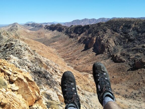
The trail is very well marked and kept in good condition, though the terrain is very rocky. I recommend supportive, durable boots such as my Lowa Baldos. We generally didn’t need gaiters, but we very much needed them for our off-track recce. Designated tent sites are generally flat and clear of debris, though a lightweight tarp and sand pegs (same as snow pegs) can be useful.
Water
Most designated campsites have water tanks maintained by NT Parks. The tanks are in good condition, but treating the water is recommended – we just used Aquatabs. Always practice good hygiene and bring sanitiser to wash your hands after using tank taps and water.
As found, bring plenty of water! For September when we walked, 5L of water per day was appropriate. Some days you will walk through points you can re-fill, others you’ll have to carry water for the day and often to the next morning.
Safety
The Larapinta is a remote trek, so bringing along a Personal Locator Beacon (PLB) such as the RescueME PLB1 is a good idea.